Fort Reconstruction Project
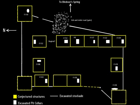 Based on the results of the archaeological investigations, an interpretation of the
layout of Bledsoe's Station around 1790 has been created. Because of the ephemeral
nature of the remains of structures at the site, a considerable amount of educated
guesswork has been a part of this interpretation. However, it remains the best supported
current interpretation of what the fort looked like around 1790.
When the project began in 1995, we expected to investigate a relatively small stockaded enclosure including perhaps 3-5 structures -- at the close of the project in 2001, we had revealed an enormous tightly packed "town" with very solid evidence of at least fourteen structures.
One lesson to be learned is that the documentary record for some places and times is very sparse -- and does not reflect the "reality" of the historical past. Archaeological research has important contributions to make for these places and times.
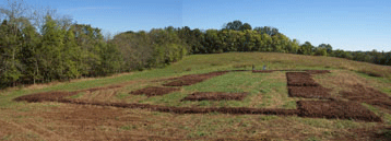 In an effort to provide visitors to Bledsoe's Fort Historical Park with a physical
representation of the interpreted layout, a passive on-site interpretive plan was
created in 2002. Given the need for relatively easy maintenance while still providing
visitors with the best current physical interpretation, the reconstruction shown in
the photograph below was selected as the best compromise. Using a one-foot thick layer
of mulch, the locations of walls and structures were outlined on the site. From an
elevated viewing platform just outside the northern edge of the enclosure, visitors
to the park can view the fort outline and use their imagination to visualize a bustling
and crowded early frontier settlement.
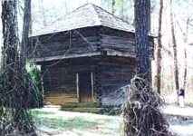 While alternative interpretations are possible, the square buildings postulated for
three of the corners of the enclosure are interpreted here as probably typical "blockhouse"
constructions. The terminus of the ditches for the stockade wall suggest a square
structure rather than a rectangular "cabin" type structure. While it is possible to
place a fourth blockhouse on the southeast corner of the enclosure, it doesn't fit
as well as another rectangular cabin to accompany the line of structures. We are fortunate
to have one surviving blockhouse from this period. This structure is the only surviving
portion of Fort Marr, a roughly contemporaneous military site in East Tennessee.
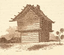 In addition, a drawing of a surviving blockhouse from a contemporary station in Davidson
County provides additional information on the construction style for these blockhouses.
The written descriptions of Ridley's Station indicates that this fortification also
included blockhouses only at three corners -- this plan being considered sufficient
to provide defense for the interior residential structures.
Extrapolating from the few historical documents available, Bledsoe's Station probably began as a relatively lightly fortified station consisting of a rectangular pattern of two rows of cabins. By the late 1780s, I suspect the more formal stockade and blockhouse features were added as raids on the Cumberland settlements intensified. Again, while alternative explanations are possible, this hypothesis of an evolution of the station plan seems to best fit the archaeological and historical evidence.
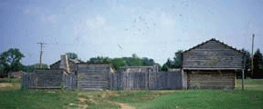 At Moss-Wright Park in Goodlettsville, a replica of a period station is maintained
alongside the historic Bowen-Campbell House. The replica includes a corner blockhouse
that might be similar to that postulated for Bledsoe's Station.


